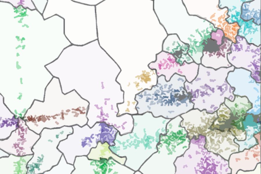
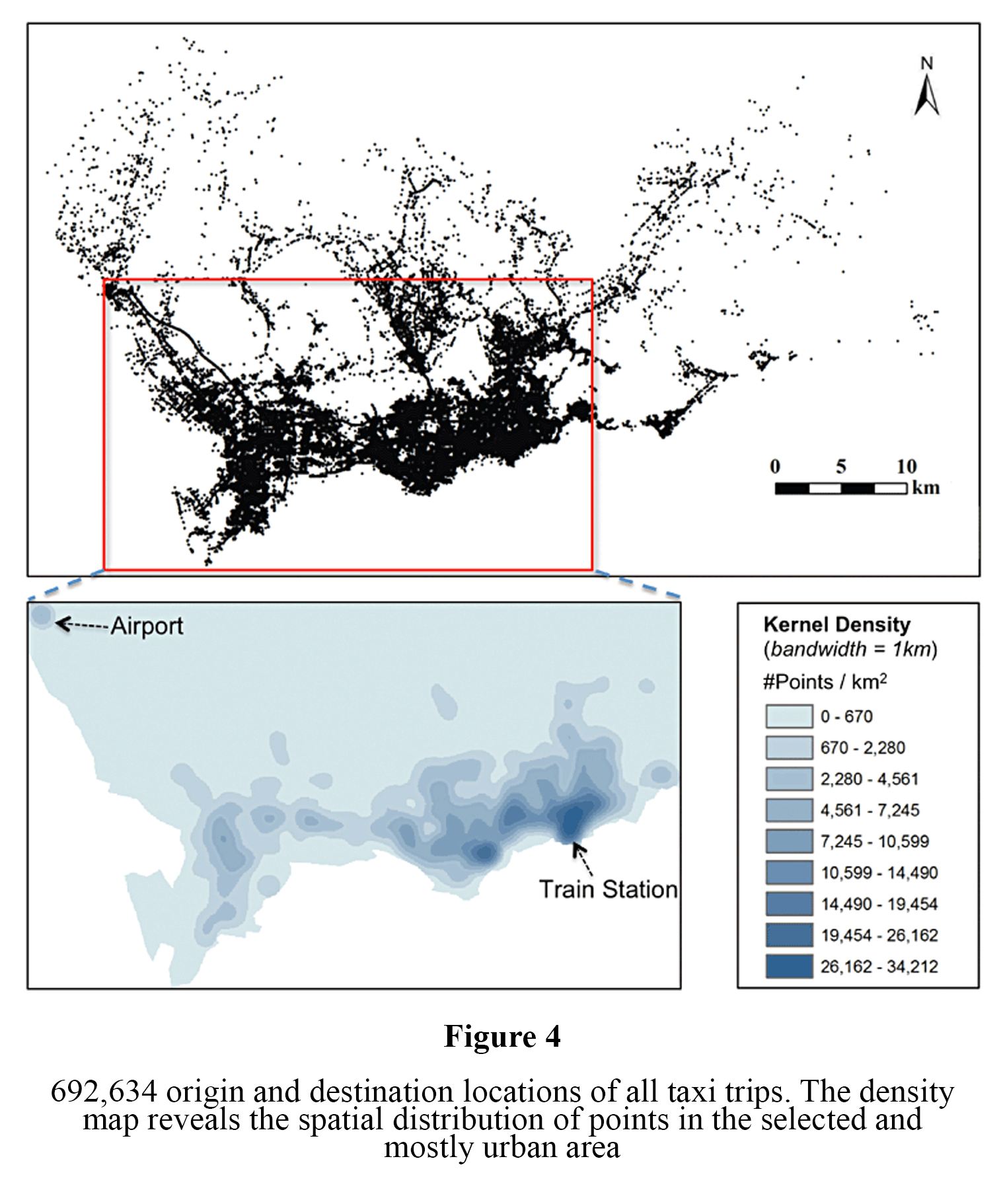
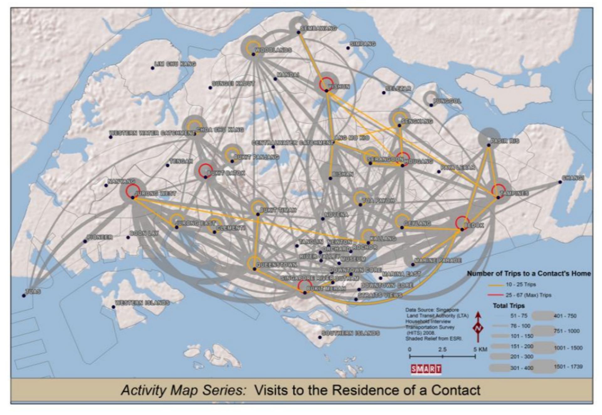
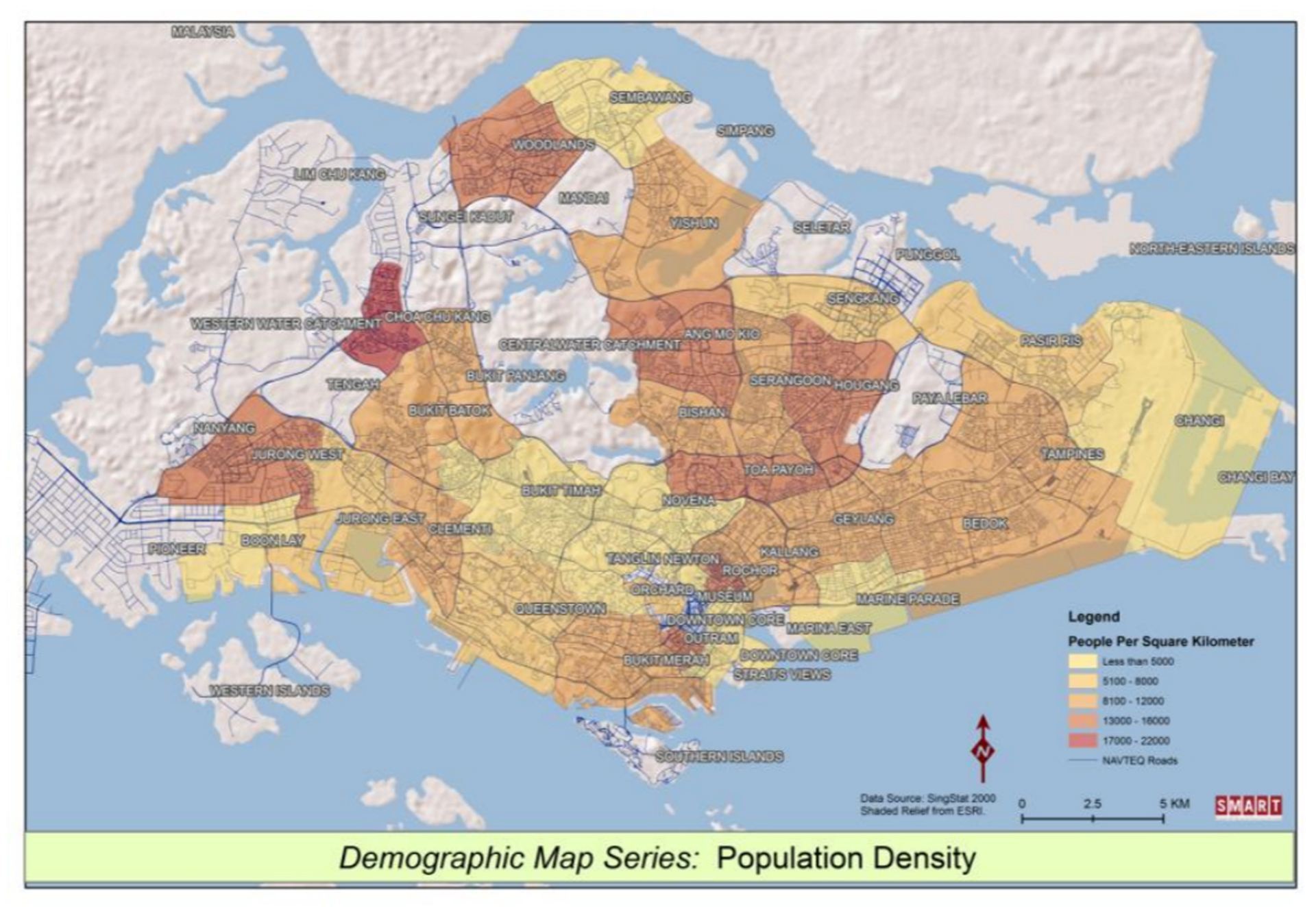
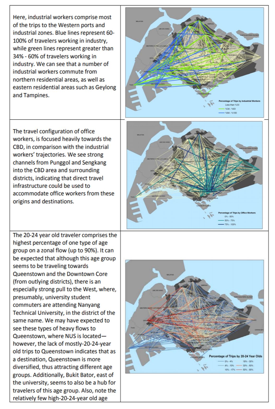
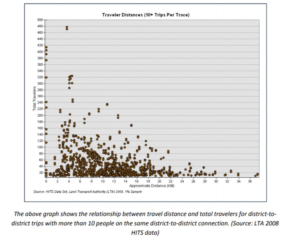
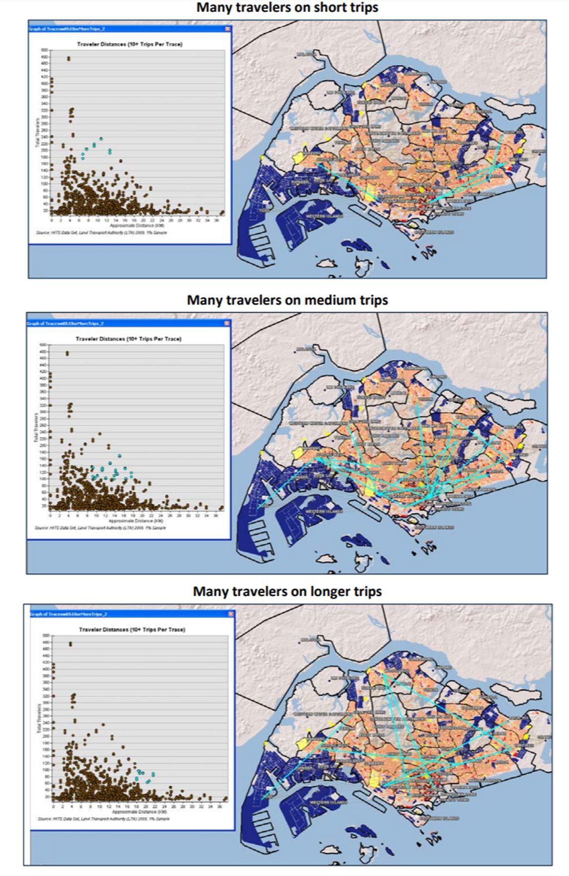
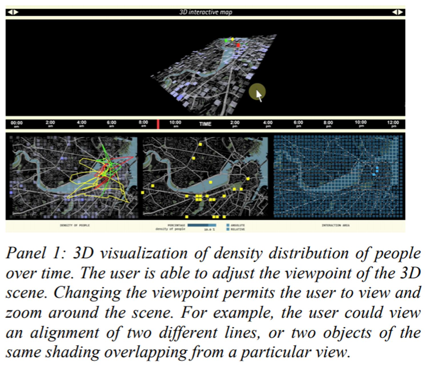
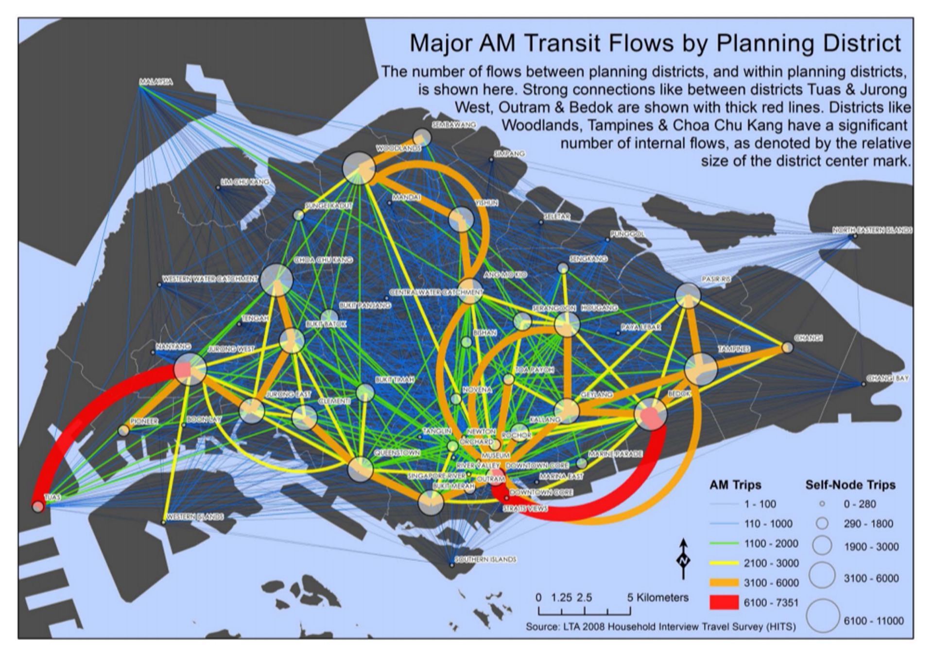
Development, Information and Social Connectivity in Côte d’Ivoire

Findings: Despite a devastating N-S Civil War, phone calls still connect N-S cities, moreso than E-W cities. Coastal cities host most of the calling.

Method: mobile phone call flows from city to city.

Good for: understanding a nationwide economic system.

Relevant Literature for Examining Social Networks in Geographic Space

Findings: Some great publications show us that social interaction studies would be better if they included GIS. For example, an otherwise tranquil marriage may be suffering because traffic in the city is keeping the couple from spending time together.

Methods: Outlining various literatures across bodies of research.

Good for: If you are looking to learn why GIS is important across industries and need a place to start, or how your company can begin to think about incorporating GIS.


Andris C (2014) Relevant Literature for Examining Social Networks in Geographic Space. Santa Fe Institute Working Paper. SFI WORKING PAPER: 2014-04-010

Support Vector Machine for Spatial Variation

Findings: Given it’s ability here to find geographic variances in students admitted to a university, the Support Vector Machine is a good tool for recognizing hidden patterns in a dataset.

Method: the paper tests Support Vector Machine against the more traditional method of Linear Discriminant Analysis.

Good for: Researchers looking for new or additional pattern recognition tools.

Discovering Spatial Patterns in Origin-Destination Mobility Data

Findings: It’s hard to create a chart showing where a million people were picked up and dropped off. We can use clusters to simplify visualization.

Method: Spacial clustering of massive GPS points and mapping cluster-based flow measures to discover spacial and temporal patterns. Results are demonstrated through taxi cabs in Shenzhen, China.

Good for: If you are interested in traffic analysis or would like a user-friendly system to show where large groups of people are moving at different times.

Neighborhood Differentiation and Travel Patterns in Singapore

Findings: Understanding how people travel through Singapore and how successful the existing travel options are in connecting those people to important places like their homes, schools and workplaces will be important in planning for an increasingly urbanized future.

Method: Activity-based modeling.

Good for: Understanding mobility in Singapore. Improving ride-share services.

Weighted Radial Variation for Node Feature Classification

Findings: A technique called Weighted Radial Variation makes it easier to visualize migration connections created from a node-edge matrix.

Method: Extracting stars where the node is the center. Creating a signature vector comprised of an edge weight circling around the node from 0-360 degrees.

Good for: If you are looking to publish maps that are easier to understand.

Predicting Migration Dynamics with Conditional and Posterior Probabilities

Findings: People’s social ties, not just cost and distance, play a role in deciding where people migrate.

Method: A Bayesian place-pair mode tested against other existing models used to predict migration like the traditional gravity model.

Good for: Understanding inter-city migration in the United States, which impacts the economic lives of cities, urban planning and more. If you are considering how to prepare for fluctuations in housing or employment based on inflows and outflows.

Redrawing the Map of Great Britain from a Network of Human Interactions

Findings: The boundaries of regional governments correspond quite well with how people communicate via phone in the UK. Scotland is the least connected to the rest of the regions of the country.

Method: Telephone data for 12 billion calls over a one month period.

Good for: Discussion of regional cohesiveness and its impacts on independence movements. Independence advocates sometimes argue that traditional government boundaries are artificial to how people actually interact. According to this, that’s not entirely true.

An ocean of information: Fusing Aggregate & Individual Dynamics for Metropolitan Areas

Findings: A new tool called Ocean of Information helps track flows of people over time with 3D visualizations.

Method: Combining where people move as groups and as individuals and offering interactive tools for finding patterns, applied to Massachusetts during a Madonna concert and the 2006 World Cup Final.

Good for: If you are exploring how viruses spread in a city or if you are planning a large public event and want to predict how crowds will behave.

Martino M, Calabrese F, DiLorenzo G, Andris C, Liu L and Ratti C (2010) An ocean of information: Fusing Aggregate & Individual Dynamics for Metropolitan Areas. Proceedings of the 14th International ACM Conference on Intelligent User Interfaces (IUI ’10). Feb 7-10, Hong Kong, China, 357-360.