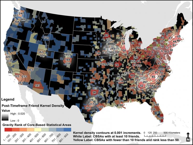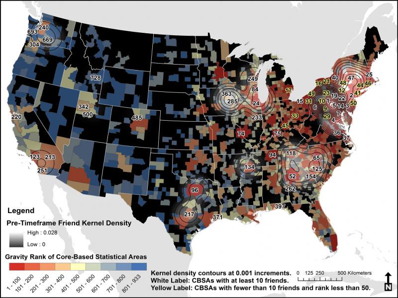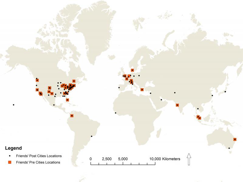
Relational geography asserts that social networks provide geographic benefits, and geographies are transmitted through the sharing of local knowledge and experience. In this work, the authors conduct a case study to map social network ties in geographic space. The authors retrieve social network matrices for 20 volunteers (egos) via Facebook.com, amounting to over 8,500 friends (alters). Each ego listed the alter’s hometown city at two time periods: at relationship inception and at the time of the study. The authors measure specific tie locations, tie expanse, deviation from a gravity model prediction, and expansion of the alter groups (family, clubs, neighbors, etc.) over time.
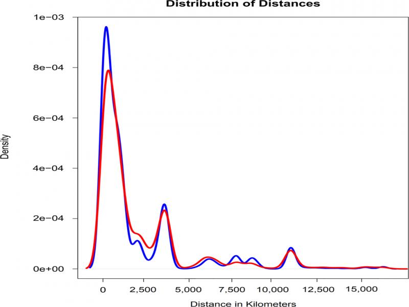
The authors find that social networks geographically spread over time, on average, from 2,679 km (standard distance) to 3,258 km (standard distance), and that the average ego had alters in 21 unique locations when they met, and 38 locations at the time of the study. Regarding friend groups, the authors discover that high school friends and friends from non-residential gatherings (ex. conferences) dispersed the most (over 1,900 km), and cultural groups (churches, sports teams) and family dispersed the least (less than 800 km) over time. Our results lead to a discussion of how mapping and measuring the distribution of social connections can uncover changing dynamics of social interaction, and one’s ability to access and engage with places through social ties.