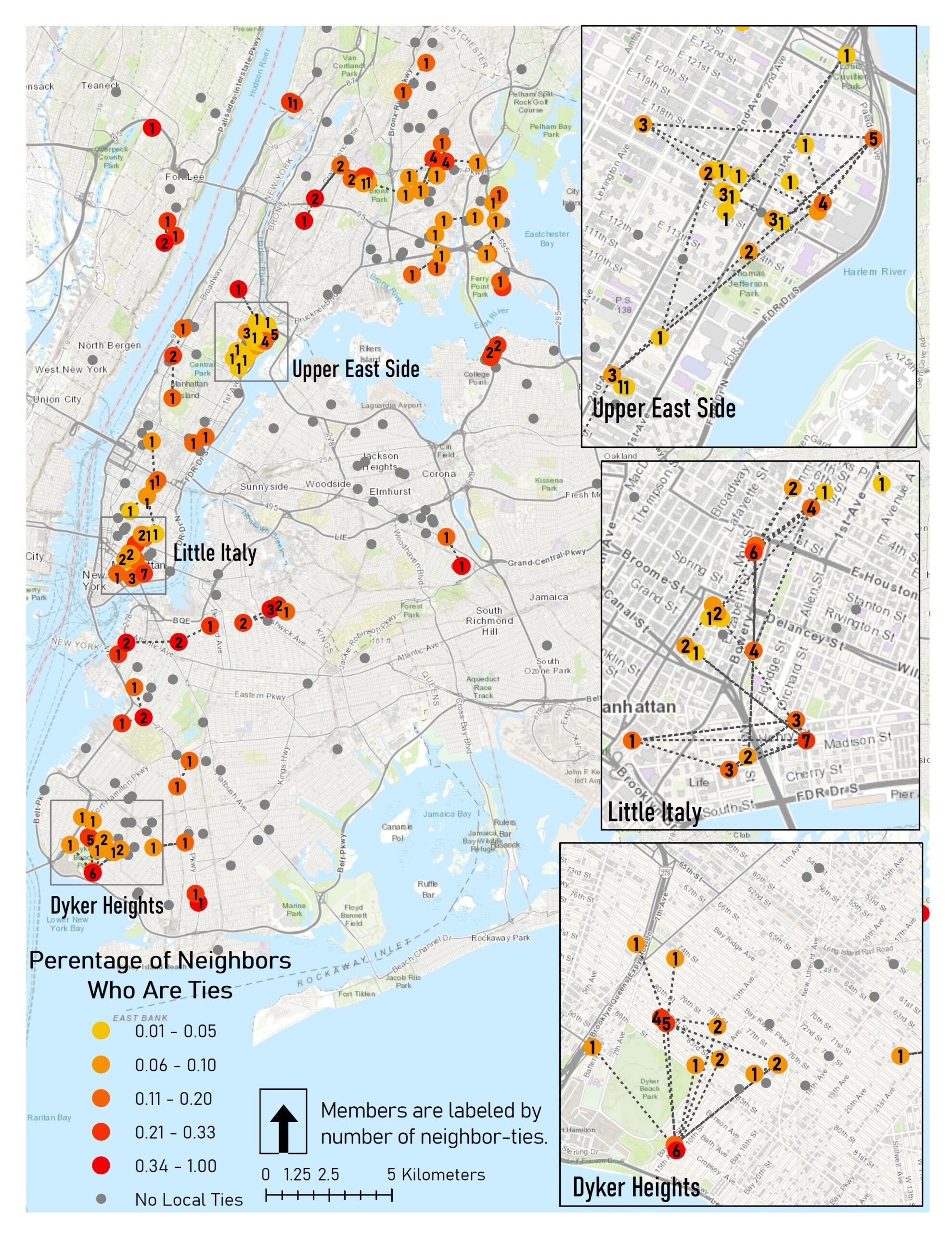
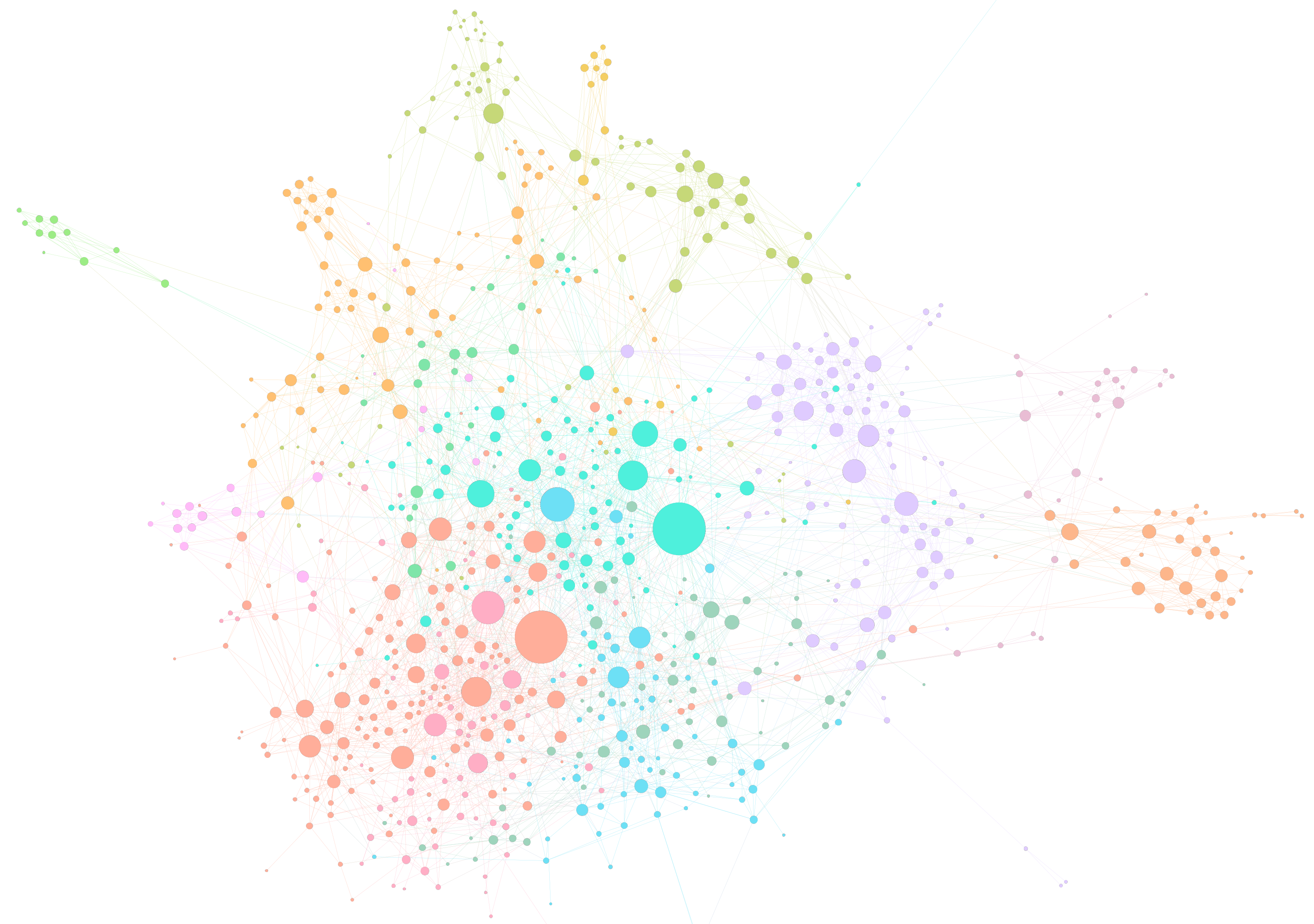
The American Mafia is known as a violent network of criminals engaged in drug trafficking, violence, and illegal activities. We analyzed a spatial social network (SSN) of 680 Mafia members where connections represent `known associates’ found through a 1960s federal crime investigation by the U.S. Federal Bureau of Narcotics. Members are geolocated to a known home address, and span across 15 major U.S. cities, concentrated in New York City. We ask four different research questions related to family, power, and coordination strategies.
Q1: Do families tend to live in clusters or distributed locations?
Q2: Do criminal associates tend to live near one another and are nearby members likelier to be associates?
Q3: Are high-degree members found near their family centers, high-income areas, or near strategic physical features?
Q4: Does the network exhibit efficiency in geographic space?
The methods we used include:
| Method (Research Question) | Question |
| Cluster/Cluster Matrix (1) (new!) | Do tight-knit networks cluster? |
| Network Density Hotspot (2) (new!) | Are spatial neighbors connected? |
| Node Role GIS Analysis (3) | Are high-degree nodes in special locations? |
| Route Factor Diagram (4) | Are network-distant ties dispersed? |
| Network Flattening Ratio (4) | Is the network spatially efficient? |
See: Andris C, DellaPosta D, Freelin B N, Zhu X, Hinger B and Chen H (2021) To Racketeer Among Neighbors: Spatial Features of Criminal Collaboration in the American Mafia. International Journal of Geographical Information Science, DOI: 10.1080/13658816.2021.1884869. [PDF]


