It’s time to hack. Come create maps, web visualizations, data + resources about an environmental issue in Atlanta. Newcomers are welcome! People who don’t like computers are welcome! People who love the trees in Atlanta are welcome. Come meet people and make a new friend and see some maps in action. This is a safe space for people to collaboratively explore issues related to the environment in Atlanta. This event is free, but we ask that people register.
NEW: Check out our hackathon guide for data and information on current issues in ATL.
Date/Time: Saturday, February 18, 2023. 12-5 PM
Location: GaTech Tech Square Research Building (directions)
First Floor Ballroom
85 5th St NW, Atlanta, GA 30308 (across the street from Waffle House.)
Starting at 12: Pizza and welcome. Followed by talks and demos throughout the afternoon–you can listen or you may be very busy hacking. 🙂
TALKS AND DEMOS:
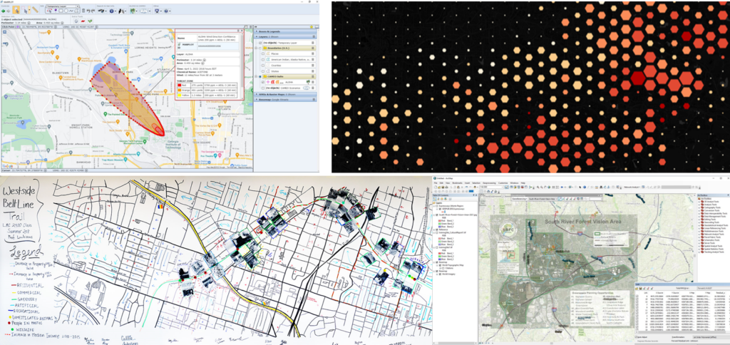
“Intro to Map Spot”: Yanni Loukissas will introduce community mapping using paper, markers, and cool tech. Map Spot is a low-cost method for pop-up map-making spaces that has been used in high schools, museums, conferences, and design offices across the U.S. Yanni runs the Local Data Design Lab at Tech.
“Creating Hexmaps from Environmental Data Points”: Taylor Shelton will show us how to make awesome ‘hexmaps’ using QGIS. Taylor is the creator of Mapping Atlanta.
“Environmental Justice Maps 101”: Teaching/demo on using mapping to show which communities are affected by (living near) an environmental hazard or area of concern.
“Future Atlanta Plans on Google Maps”: aka “Where are they putting this?” Demo on how to trace future Atlanta planning maps and show map features on Google Maps for the public, using QGIS.
Open Mic + Closing:
4:00 – 4:45 PM Open Mic!!: Share what you did, share what you want to do. At 4:45 we’ll close and thank our sponsor.
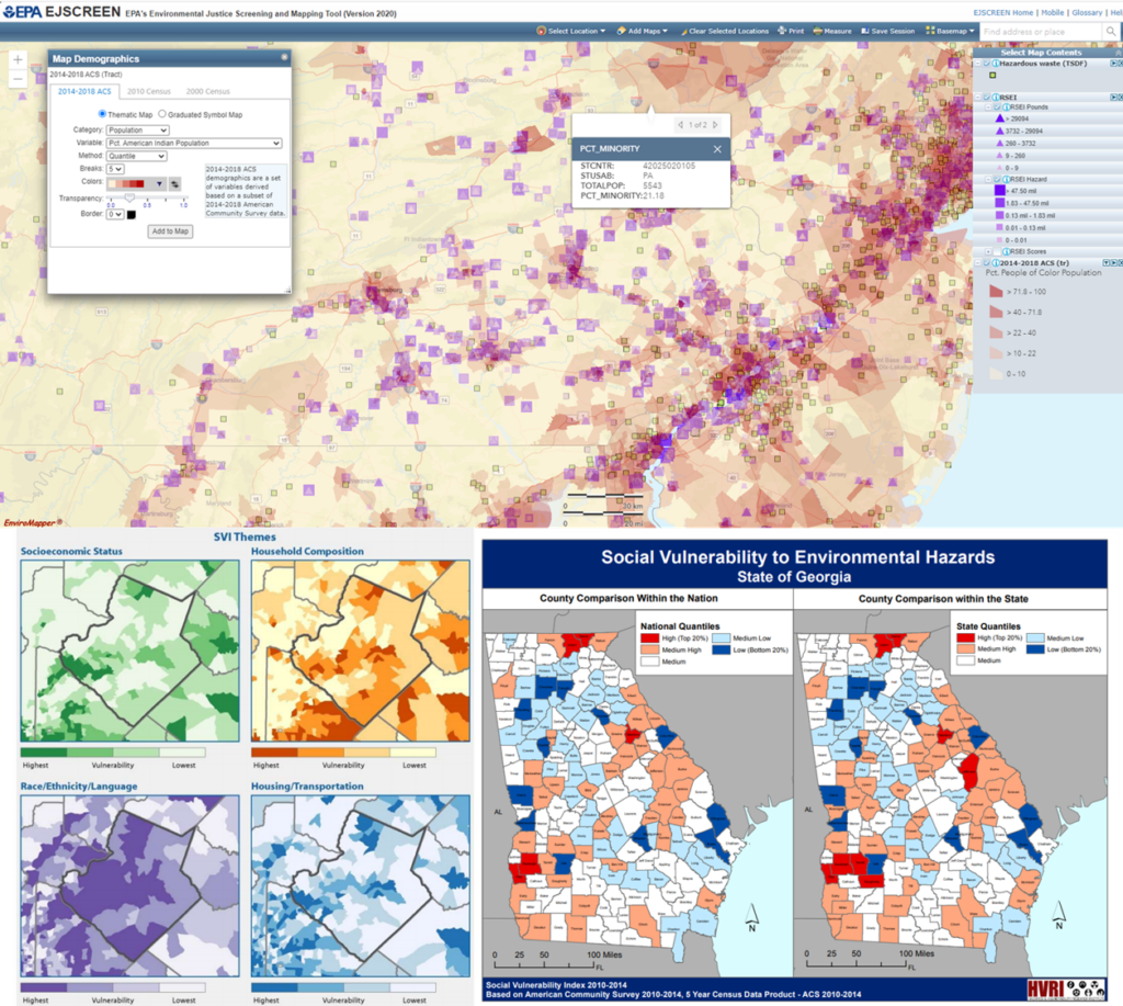
RESOURCES FROM ENVIRONMENTAL JUSTICE TALK
Software: Downloading QGIS || ALOHA
Data:
Block, Block Group, Tract-Level Shapefiles
Social Vulnerability Index (CDC)
Social Vulnerability Index (USC) South Carolina Social Vulnerability Index
Toxic Release Inventory (EPA)
EJScreen
Case Studies from Atlanta:
The Beltline
Atlantic Station
Police Training Facility: Phase I Phase II Cultural-Study
References:
Chakraborty, J., & Maantay, J. A. (2011). Proximity analysis for exposure assessment in environmental health justice research. In Geospatial Analysis of Environmental Health (pp. 111-138). Springer, Dordrecht.
Goodman, K. (2017). Environmental Justice and GIS: A Comparison of Three GIS Methods for Estimating Vulnerable Population Exposed to Brownfield Pollution in Portland, Oregon. Portland State University.

What is a hackathon? A hackathon is a gathering of people who have a common goal of creating (digital) products about a theme. These products could be graphics, interactive visualizations, maps, software, apps, statistical analysis, articles, solutions to a problem, new data sets, social media posts, etc. In 2019, we did a transportation data hackathon here at GT using data on bike sharing, subway ridership stats, highway congestion and the airport network; hackers created some interactive maps and learned more about cities through this data.
Who should come? All are welcome. No GT affiliation needed. We encourage members of the community with knowledge about Atlanta’s natural resources to join. We call for artists of any kind, graphic designers, community members and organizers, data crunchers, web people (UI or design), GIS analysts, proofreaders + writers, people who love the environment + nature, people who want to hang out and meet other people. You do not need any technical skills.
Community members and organizers: We are looking for people like you to help describe environmental problems in Atlanta and tell us more about what YOU need and would like in terms of maps and data (“I want a map of… or I’d like to know how many acres…”). Our goal is to help you tell your story and to learn more about environmental problems. Please come! And/or please let us know in advance if you have a request (email clio@gatech.edu or find us on twitter at @friendly_cities).
Do I need to be good at ‘hacking’? Nope! Zero prior knowledge or skillset or computer experience is required. Participants can expect to digitize datasets, search for their own data, clip data, make maps and charts, draw by hand, write about data on an environmental issue / current event in Atlanta that they are interested in. Technical skills, especially GIS skills, are welcome but not required.
What do I need? Bring a laptop and charger if you have one. If you don’t have one, that is ok too, just bring yourself!! You can bring markers and paper, if you have those. We’ll have pizza and cookies, and if you want to bring something to share, that’s great (If you have a cookie recipe you like, we like cookies). This is a free event.
How do I sign up? Right here. Register ASAP so we can get a headcount. We encourage teams and individuals.
Can I choose my own environmental data problem? Sure, you can focus on anywhere in the ATL area. Here’s the official hackathon guide so some local issues in ATL and datasets.
Is the building ADA accessible? Yes. We will be on the first floor. On the day of the event, text or call our organizing team (we’ll share our number closer to the date) if you experience any problems.
Please share this info. Flyers for print or social media:

Organized by Clio Andris and co-facilitated by Yanni Loukissas. Contact clio@gatech.edu for more information. Sponsored by the GT MS-GIST program.